

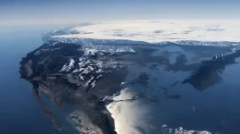
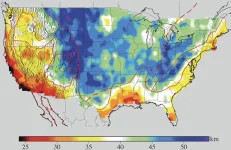
So, personally, I didn’t think Ben was descriptive enough in his video today. I feel like he left a lot out. I would’ve been more interested to know about some of the other states. Especially northern Idaho where I currently reside. In the 3rd image, he just said think of Colorado being the rudder and the country heading south. He did mention a few states rising and some going down, but he didn’t even mention Idaho which should stand to be above water in a few cases. Some of our mountains are upwards of 6,000-12,000 feet. Also from the 1st image from space looking down on North America it shows the Long Valley of California totally dry and west coast intact and the ice wall in the north boggles me, and that if the northern part of the country is going to be closer to the equator, wouldn’t that not make Colorado colder because it’s further south towards the south pole? Being that Greenland and much of North America is going to be just south of the new equator this computer model image does not sit right with me. Anybody else feel free to chip in your opinion?
Last edited:


